PLEASE NOTE: THE COURSE WILL NOT BE MARKED. We trust that as a seasoned endurance rider, ready and willing to ride double centuries, that you’re proficient at reading a route sheet and/or you’ve invested in a GPS based cycling computer into which you can upload the route.
Routing and Navigation:
Planet Ultra route sheets include lots of information to help riders navigate the course. For example, we tell you if a turn is at a stop sign (SS), traffic light (TL) or T-intersection (T-int).
GPS with turn-by-turn capabilities is mandatory for California Triple Crown “credit.”
Your entry fee includes access to RideWithGPS downloads for your Garmin (or other GPS devise) and/or your smart phone.
Route Sheets and GPS Files: Route sheets are available in excel format to registered riders if requested via email no later than 2 days before the event.
Please download the map and GPS file from RideWithGPS.com. Please further note the following very important caveats:
- A few days before the event, Planet Ultra will email an invitation to the RWGPS “event” with all routes. The links in the invitation allow you to use subscription-based functions even if you only have a free account.
- Never depend solely on a bike mounted GPS. Bring your route sheet, and know how to follow it. Use the RWGPS app on your smart phone as backup.
- GPS batteries on many “bicycle” GPS units may not last for a century. Make sure you’ve arranged for additional power.
- Click here to view and download the map including elevation profiles and GPS download.
Route Description:
Caveat: This is a very urban route with lots of traffic lights, stop signs and sometimes heavy vehicle traffic. The locals love it — but if you’re from out of town and are expecting quiet roads and lots of amazing scenery, you might be disappointed. Just being honest.
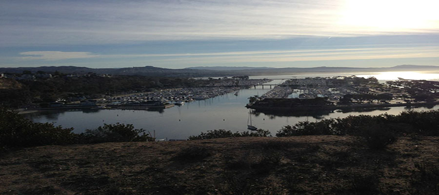
The Camino route is shaped like a dog bone, with loops on each end of an out-and-back course. Beginning in Lake Forest, you’ll head to the coast via the rolling hills of Irvine and Turtle Rock and get your first view of the Pacific Ocean as you blast down Newport Coast and hang a left on PCH. After riding through a bit of Newport Beach and Laguna Beach on PCH, you’ll hang a left and head back inland, meandering up Laguna Canyon Road. Hang a right on El Toro, and make your way through Aliso Viejo and Laguna Niguel, then blast down Crown Valley to the Coast and Dana Point. From Dana Point you’ll be on the coast through San Clemente, and along the bike path through San Onofre, all the way to Oceanside. From there, you’ll head inland, heading towards Bonsall and lunch at the All Seasons Campground. The climbing starts again after lunch, with a beautiful loop out towards Fallbrook. You’ll wind up back in Bonsall, and repeat the course back to the coast, and north through Dana Point again. The final leg has the lion’s share of the climbing, up from San Clemente to Antonio Parkway, through Trabuco Canyon, across Santiago Canyon and then a fun downhill finish on Jamboree to Portola then a bump of climbing to the finish line.
193 miles with about 11,570′ climbing.

 CAMINO REAL DOUBLE CENTURY