SOLVANG AUTUMN DOUBLE CENTURY
 
October 25, 2025
BUELLTON, CALIFORNIA
Brevet-Style Only
You must self-support or bring private SAG.

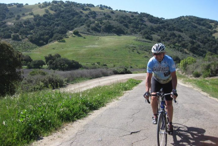
Just as beautiful, but significantly more challenging than the Spring event!**
A spectacular double century in Southern California’s most popular cycling region!
192 miles with about 12,400′ of climbing!
DOUBLE METRIC CENTURY OPTION
123 miles with about 6900′ climbing!
********************************************************

Held in conjunction with Solvang Sequel metric century and half century.

**Please note: Some of the road surfaces in and around Santa Ynez Valley can be, and often are, pretty lousy. Expect cracks, bumps and potholes on Foxen Canyon, Santa Rosa Road and Drum Canyon. Please bring appropriate, wider, more cushy tires.

General Information and Ride Rules – Please Read!

Click here for results from prior years.

This brevet-style California Triple Crown event is held in conjunction with our Solvang Sequel metric century and half century. Riders must be willing to primarily self-support. 

2025 Entry Fees*:  $80 cash at check-in with reservation
Entry includes limited limited support on 1st half of the DC, lunch at the mid point, per-rider donation to Life Sports Foundation.

Before registering, please read our registration and cancellation policies.

REGISTRATION OPENS APRIL 1
Please READ THE RULES before signing up!

Use the SignUp bottom to reserve your spot. Please note: There is limited support on 1st half and no support on 2nd half. You must be willing to be 100% self sufficient (including getting back to Buellton if you need to DNF).

Start/Finish Host Hotel:
Our host hotel is the Hampton Inn & Suites located at 600 McMurray Road in Buellton, (805) 686-1555. Call and request the Planet Ultra special rate of $TBD per night. PLEASE book your room in our block. Our future relationship with our host hotels depend on our booking the rooms they set aside for us.

We realize hotels in this area are very expensive; so try AirBnB as well.

Rider Check-In:
TBD

Parking:
If you’re staying somewhere other than the Hamptonn Inn, please leave your car and ride to the start. If you’re driving to Buellton Saturday morning, please be respectful about where you park. Allow enough time to find proper parking; and please don’t park in the Hampton lot.

How To Get There: 
Use Hwy 101 to get to Buellton from either north or south. Click here for a map.

Start Times:
6:30am for all riders who plan to finish in 14-15 hours.
7am for all riders who plan to finish in under 14 hours.
No in between starts please. 

Route Description:

PLEASE NOTE: The road surfaces in and around the Santa Ynez Valley can be, and often are, pretty lousy. Expect cracks and bumps and potholes on Foxen Canyon, Santa Rosa Road and Drum Canyon, for sure. Please bring appropriate, wider, more cushy tires.

Please note: We will likely create a new route for 2025 to avoid Drum Canyon. Below is a description based on prior years.

The route is basically two centuries starting/ending in Buellton. On the first half, riders will do a quick, easy warm-up loop on the back roads of Solvang, Ballard, Santa Ynez and Foxen Canyon before heading out to enjoy the rolling hills of Santa Rosa Road. Rolling through Lompoc, you’ll hit the first sustained climb of the day, up Harris Grade, followed by a super fast and fun descent to Highway 1. Then you’ll head south to Los Alamos and up and over Drum Canyon then back to Buellton.

The second half has a bit more climbing, starting with Drum Canyon in reverse! And YES! The road is better on the Los Alamos side; so perhaps a less bumpy descent; and again, in full daylight! Up and over, you’ll drop down to Los Alamos (again). Then it’s time for some more roads-less-traveled; north on the 101 just a few miles and up Palmer Road, with a steep pitch right at the top before you plunge back down into Sisquoc. From here you’ll do an awesome out-and-back on Tepusquet Road, which has superb pavement and super fun, twisty descending. You’ll return to Buellton via Foxen Canyon, Zaca Station and Ballard Canyon which all climb and roll back to Buellton.

192 (or so) miles with about 12,400′ of climbing. This route is significantly more challenging than the Spring route – but the change has also made the route more unique, with new roads and new challenges. The route stays closer to Solvang/Buellton, allowing for shorter options if needed/desired.

Given the distance between locations where food/water is available, a camelbak or other hydration system is highly recommended.

Routing and Navigation:
Planet Ultra route sheets include lots of information to help riders navigate the course. For example, we tell you if a turn is at a stop sign (SS), traffic light (TL) or T-intersection (T-int). We know that riders prefer course markings; however, many of the towns/cities/counties specifically forbid it. Further, your Planet Ultra staff travels to the event destination the day before to make everything happen; so we can’t mark the course in advance. If we have the manpower, we’ll do our best to mark the course (unless it’s forbidden by our permits, otherwise illegal, somewhere that locals would be really upset about it, or the turn is at a place that’s very obvious).
This is the type of route where a GPS with turn-by-turn capabilities will come in handy. Please understand and take responsibility for navigation.

Route Sheets and GPS Files:  Route sheets are available in excel format to registered riders if requested via email between two weeks and five days before the event. We cannot guarantee that advance route sheets will be 100% accurate. Though not anticipated, last-minute routing changes may be required.

You may also download maps and GPS files from RideWithGPS.com. Please note that advance route sheets and gps files are provided as a courtesy and you use them at your own risk. Planet Ultra does not guarantee accuracy. Please further note the following very important caveats:

  1. The ROUTE SHEET is gospel. Whenever the route sheet and the GPS unit disagree, the route sheet is correct.
  2. A GPS can (and will) route a rider over a cliff. There’s really no substitute for the human brain, so please use yours.
  3. Never depend solely on a GPS. Bring your route sheet, and know how to follow it.
  4. GPS batteries on many “bicycle” GPS units may not last for a century. Make sure you’ve arranged for additional power.
  5. Click here to view and download the 1st half of the ride; click here for the 2nd half. Full route of Solvang Fall Double (please do NOT use the full route to navigate. The route doubles back on itself and creates “confusion” for your Garmin. Click here to view and download the Double Metric Route.

Support Provided:
This event is held brevet-style. Lunch will be served at the halfway point. Other than that, you’re required to fend for yourselves.

Personal SAG Vehicles:
Encouraged! As this event is brevet-style, you’re welcome to bring private SAG provided they are willing to help others if they’re in the right place at the right time. Private SAG drivers must sign a waiver.